

Mataruahou (Bluff Hill) Lookout
Walks & views · Napier & Ahuriri
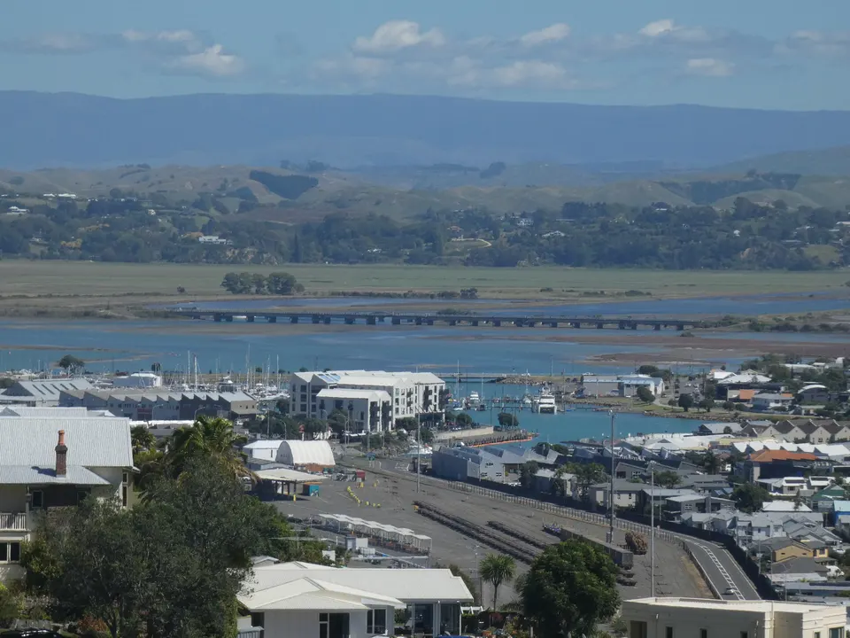
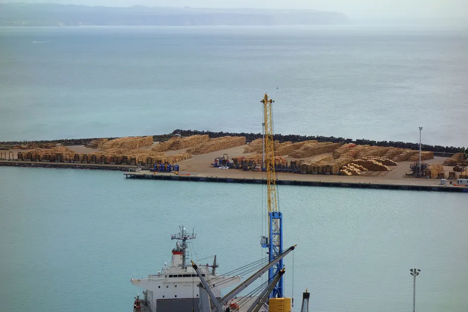
The Mataruahou (Bluff Hill) Lookout is on top of the hill above Napier Port, with views across Hawke Bay from Māhia Peninsula to Cape Kidnappers / Te Kauwae-a-Māui. You can drive up Lighthouse Road to a car park with toilets, or walk up from Marine Parade, about 4.4 km and 50 minutes return. It is free.
Good to know
| Where | Top of Lighthouse Road, Mataruahou (Bluff Hill), above Napier Port |
|---|---|
| By car | Lighthouse Road leads to the lookout car park, with toilets |
| Walk | From Marine Parade: about 4.4 km and 50 minutes return. Council grade: hard. |
| Height | The summit of Mataruahou is 105 m above sea level |
| Views | Ruahine Range to the hills beyond Wairoa; Māhia Peninsula to Cape Kidnappers / Te Kauwae-a-Māui |
| Cost | Free |
Where is Bluff Hill Lookout, and how do you get there?
The lookout is at the top of Mataruahou (Bluff Hill), the hill between central Napier and Ahuriri. By car, follow Lighthouse Road to the end, where there is a car park with toilets.
On foot, Hawke’s Bay Tourism describes a route from Marine Parade: head north past Ocean Spa, turn left into Coote Road past the waterfall in Centennial Gardens, climb Priestley Road and the ramp to Priestley Terrace, then turn right into Lighthouse Road. A white picket gate on the left is the entrance to the Karetoki Whare (Sturms Gully) reserve; steps and a path lead up to the lookout. Allow about 50 minutes return for 4.4 km, with some steep sections. The i‑SITE has a route map.
What can you see from Bluff Hill?
The lookout looks straight down on Napier Port. Napier City Council says you can see much of Hawke’s Bay, from the Ruahine Range to the hills beyond Wairoa, and across the bay from Māhia Peninsula to Cape Kidnappers / Te Kauwae-a-Māui.
The army occupied the hilltop in the Second World War, and the lookout was built on top of its concrete gun emplacements. The council took over the reserve in 1957.
Which walks go up Mataruahou (Bluff Hill)?
Napier City Council lists three walks that start at the Ocean Spa pool complex on Marine Parade:
| Walk | Length | Grade | Route |
|---|---|---|---|
| Mataruahou (Bluff Hill) Walk | 4.4 km | Hard | Seaview Terrace, Gladstone Road and Coote Road to Lighthouse Road and the lookout, back down Hornsey Road and Breakwater Road |
| Ramps & Steps Walk | 5.3 km | Hard | Madeira Steps, Cobden Road, Thompson Road and Karetoki Whare (Sturms Gully), finishing on Coote Road |
| Round the Hill Walk | 7.4 km | Easy | Around the foot of the hill via Ahuriri and back along the coastal path |
The council gives no walking times. The streets on the hill are steep, and parts of the routes are on roads, so wear good shoes.
Why is it called Mataruahou?
Mataruahou is the official name of the hill. The Ahuriri Hapū Deed of Settlement gave the name Mataruahou to the hill that had been called Bluff Hill, Hospital Hill, Napier Hill and Scinde Island, and renamed Sturms Gully as Karetoki Whare. James Cook recorded “Bluff Head” in his log on 15 October 1769. Te Ara describes the original town site as a near-island between the sea and the inner harbour, whose floor the 1931 earthquake raised.
Nearby
More in Napier & Ahuriri
Questions about Mataruahou (Bluff Hill) Lookout
Can you drive to Bluff Hill Lookout?
Yes. Lighthouse Road goes up to the lookout car park, which has toilets.
How long is the walk up Bluff Hill?
From Marine Parade it is about 4.4 km and 50 minutes return, with some steep sections.
What can you see from Bluff Hill Lookout?
Napier Port below, and on a clear day the bay from Māhia Peninsula to Cape Kidnappers / Te Kauwae-a-Māui, with the Ruahine Range inland.
Sources
Checked 19 November 2026 against these sources. Rules, prices and times change, so check the official page before you go. How we check facts