

Napier & Ahuriri
Napier · Ahuriri · Mataruahou (Bluff Hill) · Westshore · Taradale

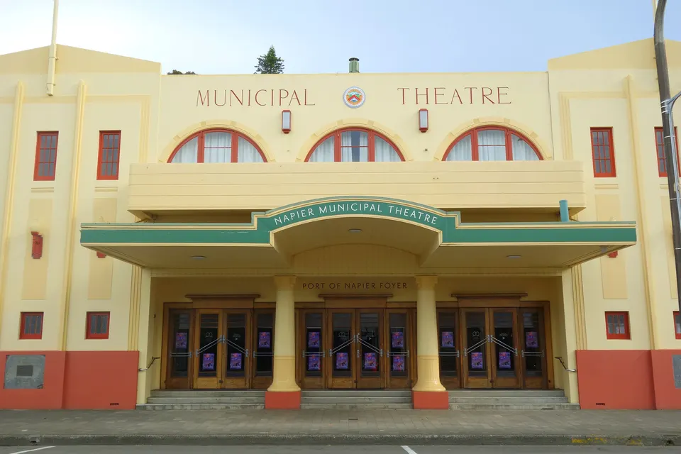
Napier is the seaside city on Hawke Bay whose town centre was rebuilt in Art Deco style after the 1931 earthquake. Marine Parade runs along its shore, and Ahuriri, the old port, lies on the other side of Mataruahou (Bluff Hill). Hawke’s Bay Airport is about 10 minutes’ drive from the city centre.
What are the best things to do in Napier?
Most visitors start in the compact town centre, which was rebuilt in the early 1930s after the earthquake and fires of 3 February 1931. The Art Deco Trust runs guided walks from Memorial Square, or you can walk on your own with its guide. The background is on our Napier Art Deco and 1931 earthquake guide.
Across the road from the shops, Marine Parade has gardens, the statue of Pania of the Reef, the National Aquarium of New Zealand and the Ocean Spa pools. The region’s museum and art gallery, now called Kahukura Hawke’s Bay Museum (MTG Hawke’s Bay), is on the corner of Marine Parade and Tennyson Street, and entry to its exhibitions is free. For a view over the port and the bay, go up Mataruahou (Bluff Hill) to the lookout. Ōtātara Pā, one of the largest and oldest pā sites in Hawke’s Bay, is on the edge of Taradale.
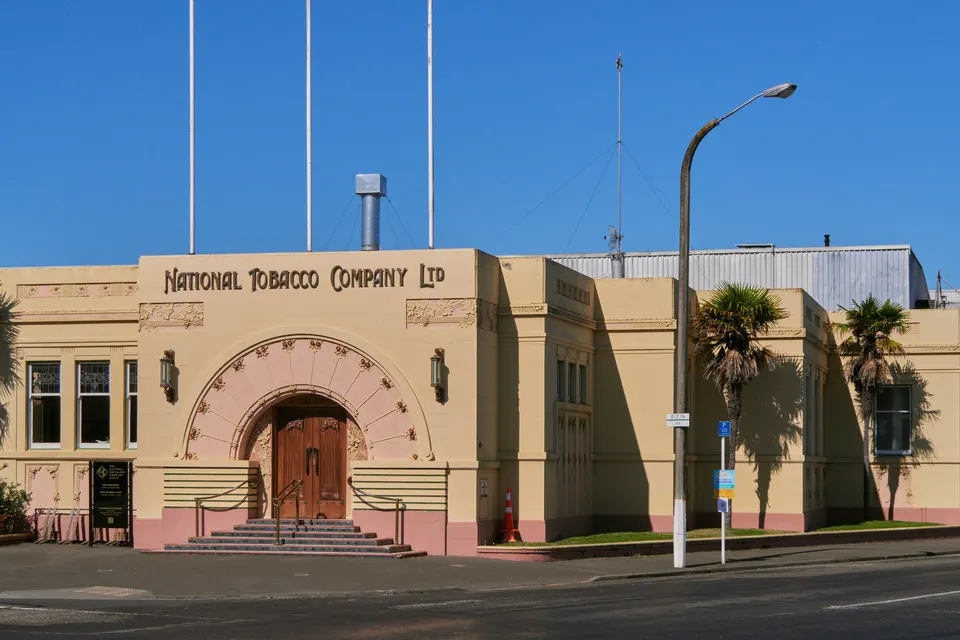
Napier Art Deco walk
Guided or self-guided walks through Napier’s 1930s streets, starting at the Art Deco Trust in Memorial Square.
Good to know & how to get there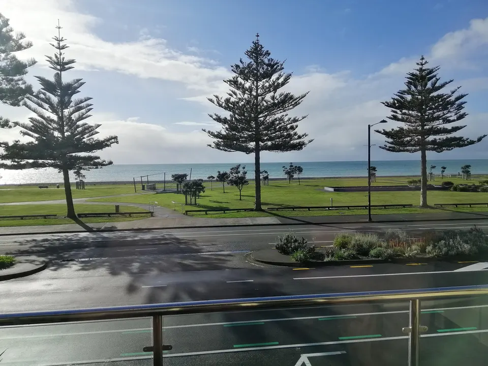
Marine Parade
Napier’s seafront, with gardens, Pania of the Reef and a shoreline path. Shingle beach, not for swimming.
Good to know & how to get there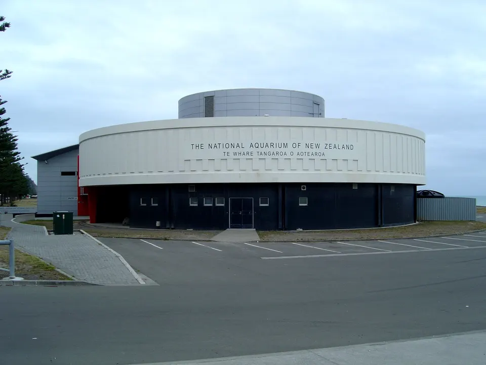
National Aquarium of New Zealand
Little penguins, kiwi and an oceanarium tunnel on Marine Parade. Open daily, 9am to 5pm.
Good to know & how to get there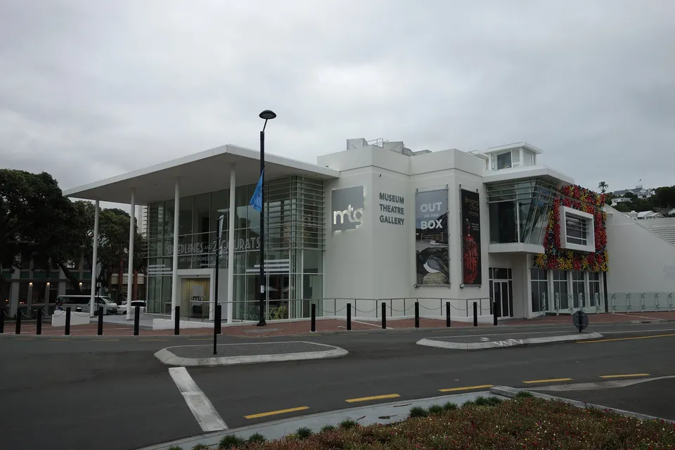
Kahukura Hawke’s Bay Museum (MTG)
The region’s museum and art gallery on Marine Parade, with a 1931 earthquake exhibition. Free entry.
Good to know & how to get there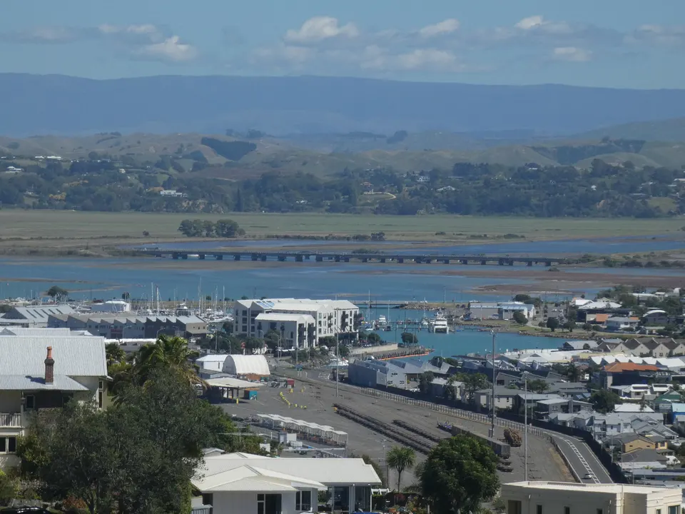
Mataruahou (Bluff Hill) Lookout
Hilltop lookout over Napier Port and Hawke Bay. Drive up Lighthouse Road or walk up from Marine Parade.
Good to know & how to get there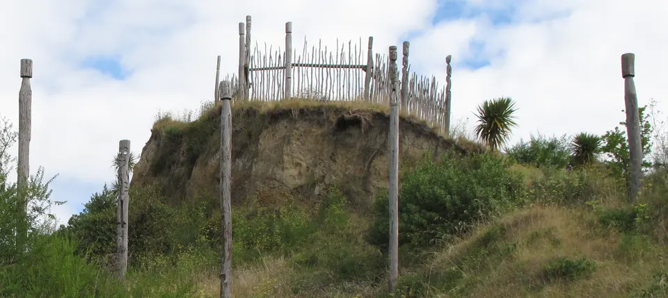
Ōtātara Pā Historic Reserve
One of Hawke’s Bay’s largest and oldest pā sites, on a 1.6 km DOC track above the Tūtaekurī River.
Good to know & how to get thereHow do you get to Napier?
Hawke’s Bay Airport is on the northern edge of the city, about 10 minutes’ drive from central Napier and about 25 minutes from Hastings. Hawke’s Bay Tourism says Air New Zealand has daily flights from Auckland, Wellington and Christchurch. goBay bus route 4 stops just outside the terminal and links the airport, Napier and Bay View, Monday to Saturday. InterCity coaches stop at the airport on request.
By road, the Napier i‑SITE gives about 2 hours from Taupō, 3 hours from Gisborne, 4 hours 30 minutes from Wellington and 5 hours from Auckland, and says times depend on conditions. Hawke’s Bay Tourism puts Taupō at about 90 minutes along State Highway 5. Roads can close after heavy rain, so check NZTA’s Journey Planner before you set off.
Cruise ships berth at Napier Port. It is a working port, so you cannot walk out; shuttles take passengers about five minutes to the i‑SITE on Marine Parade. Most ships call in the warmer months, and Napier Port publishes each season’s schedule on its website.
Where is the Napier i‑SITE?
The Napier i‑SITE Visitor Centre is at 100 Marine Parade, next to the Sound Shell, and is open every day from 9am to 5pm. Staff can book tours, activities and accommodation in Napier and around Hawke’s Bay. Phone +64 6 834 1911 or freephone 0800 847 488.
On cruise days, the i‑SITE’s cruise ambassadors meet passengers and hand out a guide to the central city. Hawke’s Bay Tourism says it also has a route map for the Bluff Hill walk and heritage brochures for Napier Hill and Ahuriri.
Is Napier beach safe to swim?
Not the beach along Marine Parade. The shore here is shingle, the beach is steep and drops off quickly, and there is a strong undertow. In November 2022 the Napier mayor said it is not a swimming beach, and the Pacific Surf Life Saving Club moved its summer patrols to Ahuriri (RNZ, 25 November 2022). The council has put permanent water safety signs along the parade.
For a swim, go to the sheltered beaches at Ahuriri along Hardinge Road. Pacific SLSC patrols Ahuriri Beach at weekends through the summer, with extra weekday patrols in the school holidays; its Surf Life Saving New Zealand page lists this season’s days and times. Further north, Westshore Beach is sandy, and Westshore SLSC patrols it each summer between Labour Weekend and late March.
Pandora Pond, in the lower Ahuriri Estuary, is used for swimming, sailing, kayaking and waka. The council warns that its water is not always clean enough, because stormwater and runoff drain into it. Check water quality on LAWA’s Can I swim here? and patrol times on Safeswim before you go.
What is there to see in Ahuriri?
Ahuriri is the port suburb on the far side of Mataruahou (Bluff Hill) from the town centre, and Napier itself was once called Ahuriri. Te Ara says the inner harbour here was a valued Māori food source and served as Napier’s port from 1855 until the 1931 earthquake lifted the sea floor. In the 2000s many of the old warehouses became cafés and bars. Look out for the National Tobacco Company Building on the corner of Ossian and Bridge streets, whose entrance was rebuilt in 1933 (Heritage New Zealand).
Behind Ahuriri lies the Ahuriri Estuary, which Napier City Council also calls Te Whanganui-a-Orotū. The earthquake lifted the old lagoon by more than 1.5 m, and drainage and reclamation have since cut the estuary to about 470 ha. It is a wildlife refuge of national importance, where royal spoonbills and white herons wade and breed, and 29 fish species use it at some stage of their lives.
The Hawke’s Bay Trails Water Ride starts at the Perfume Point lighthouse and follows the harbour path around Ahuriri to Westshore and Bay View, with an option along the upper estuary. Closures and detours are posted on the Hawke’s Bay Trails news and alerts page.
What is there to do in Taradale?
Taradale, on the south-western side of the city, is Napier’s largest suburb, Te Ara says. It governed itself until it joined Napier in 1968; it is home to the Eastern Institute of Technology, and there are large vineyards close by at Missionview.
Napier City Council lists several walks here. Halliwells Walk (2 km) climbs to the top of Sugar Loaf, 127 m above sea level, and the Riverside to Ridgetop Walk (3.9 km) passes through Otatara Reserve with a side trip to the pā. The Water Ride’s Puketapu Loop, about 18 km, starts at Pettigrew Green Arena in Taradale and follows the Tūtaekurī River.
What should you know about tsunami in Napier?
Hawke’s Bay Emergency Management says the first wave of a tsunami from a nearby earthquake could arrive within about 15 minutes. If an earthquake is long (more than a minute) or strong (hard to stand up), leave the coast straight away, on foot or by bike, and head inland or uphill without waiting for a warning.
You can check whether an address is in the tsunami evacuation zone with the online map on the Hawke’s Bay Emergency Management tsunami page.
Questions about Napier & Ahuriri
How far is Hawke’s Bay Airport from Napier?
About 10 minutes’ drive from central Napier and about 25 minutes from Hastings, according to Hawke’s Bay Tourism. goBay bus route 4 links the airport and Napier, Monday to Saturday.
Can you swim at Marine Parade in Napier?
It is not recommended. The beach is steep shingle with a strong undertow, and lifeguards no longer patrol it. Swim at the patrolled beaches at Ahuriri or Westshore instead.
Where is the Napier i‑SITE?
At 100 Marine Parade, next to the Sound Shell. It is open every day from 9am to 5pm.
Do cruise ships stop in Napier?
Yes, in summer. Ships berth at Napier Port, and shuttles take passengers about five minutes to the i‑SITE on Marine Parade.
How long is the drive from Taupō to Napier?
About 1 hour 30 minutes to 2 hours on State Highway 5. Hawke’s Bay Tourism says about 90 minutes, and the Napier i‑SITE says 2 hours.
Sources
Checked 19 November 2026 against these sources. Rules, prices and times change, so check the official page before you go. How we check facts
- Napier i‑SITE Visitor Centre
- Napier i‑SITE: Cruise into Napier
- Napier i‑SITE: Travel tips (driving times)
- Hawke’s Bay Tourism: Getting here
- Hawke’s Bay Tourism: i‑SITE visitor information centres
- Hawke’s Bay Tourism: Getting around (public transport)
- Hawke’s Bay Airport: Buses
- Napier Port: Cruise schedule
- Napier City Council: Marine Parade Foreshore Reserve
- Napier City Council: Westshore Beach
- Napier City Council: Ahuriri Estuary / Te Whanganui-a-Orotū
- Napier City Council: Taradale walkways
- Te Ara: Hawke’s Bay places – Napier
- RNZ: Lifeguards to move from dangerous Napier beach (25 November 2022)
- Hawke’s Bay Today: Napier beach patrols move to Ahuriri (21 November 2022)
- Surf Life Saving New Zealand: Pacific SLSC
- Surf Life Saving New Zealand: Westshore SLSC
- LAWA: Can I swim here?
- Safeswim
- Hawke’s Bay Tourism: Marine Parade Gardens
- Hawke’s Bay Tourism: Hawke’s Bay Trails Water Ride
- Hawke’s Bay Tourism: Bluff Hill Lookout walk
- Kahukura Hawke’s Bay Museum: Visit
- DOC: Ōtātara Pā Historic Reserve
- Hawke’s Bay Emergency Management: Tsunami
- Hawke’s Bay Emergency Management: Tsunami evacuation zone updated (19 August 2026)
- Wikipedia: Napier (coordinates)
- Heritage New Zealand: National Tobacco Company Building (List No. 1170)
- NZTA: Journey Planner
- Hawke’s Bay Trails: Trail news and alerts
- Wikipedia: Ahuriri (coordinates)
- Wikipedia: Taradale (distance from the city centre)