

Māhia Peninsula
Beaches & walks · Wairoa, Māhia & Waikaremoana
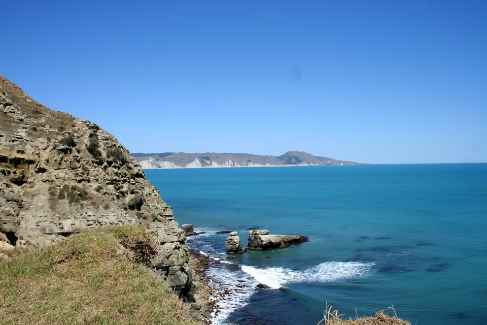
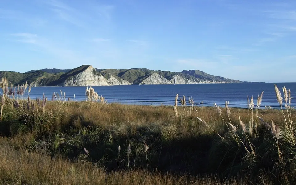
The Māhia Peninsula reaches south into the sea at the northern end of Hawke’s Bay, east of Wairoa. It is about 21 km long and 15 km wide. Turn off State Highway 2 at Nūhaka. Mokotahi Hill, at the south end of Māhia Beach, is about 46 km from Wairoa and takes 10 to 15 minutes to climb.
Good to know
| Size | About 21 km long and 15 km wide at its widest. |
|---|---|
| Getting there | Turn off State Highway 2 at Nūhaka and follow the signs to Māhia. |
| Mokotahi Hill | 10 to 15 minutes up from a signposted car park. Free public access. |
| Scenic reserve loop | 4.5 km, about 2 hours 30 minutes, from the end of Kinikini Road. |
| Beaches | Māhia Beach and Ōpoutama (Blue Bay), both with public toilets. |
| Launch site | Rocket Lab Launch Complex 1, at Ahuriri Point on the southern tip. |
What is there to do on the Māhia Peninsula?
Most people come for the beaches. The Wairoa i‑SITE describes Māhia Beach as a safe, shallow family beach for swimming, paddle boards and surfing, with public toilets next to the Māhia Fishing and Boating Club. Ōpoutama, on Blue Bay Road, is a sheltered white-sand beach that the i‑SITE calls safe for swimming and good for learner surfers; dolphins are sometimes seen in the surf.
The i‑SITE also lists Black’s Beach and Māhanga Beach, and surf, fishing and diving spots around the peninsula. On land, you can climb Mokotahi Hill for the view or walk the forest loop in the Māhia Peninsula Scenic Reserve.
How long is the walk up Mokotahi Hill?
About 10 to 15 minutes up, says Hawke’s Bay Tourism. The track starts from a signposted car park about halfway between Māhia Beach and Taylor’s Bay. It is well formed and has been widened, with a steady climb and several places to rest. From the top you look over Māhia Beach to Ōpoutama and across the northern waters of Hawke Bay.
The white-cliffed headland is a significant site for Ngāti Kahungunu, with a long history of occupation; pits and terraces can still be seen on the hill. The Ormond family gave the headland to the QEII National Trust to protect it, the track was upgraded in 2018, and public access is free.
What is the Māhia Peninsula Scenic Reserve Track like?
It is a 4.5 km loop of about 2 hours 30 minutes through semi-coastal forest of tawa and kohekohe, with stands of nīkau, rimu and rewarewa, a fern-lined stream, a picnic area and a lookout over the Wairoa coast. The reserve is about 7 km south of Māhia Beach, at the end of Kinikini Road, which is narrow, winding and unsealed.
DOC says the track is steep in places but not hard for someone of average fitness, and suitable for older children. There are stream crossings, so expect wet feet and wear sturdy shoes. Follow only the orange triangle markers; other colours mark conservation work lines. German wasps and their nests are common along the track in summer, so think about another time of year if you are allergic to stings.
Is Rocket Lab on the Māhia Peninsula?
Yes. Te Ara says Rocket Lab’s Launch Complex 1, New Zealand’s first commercial spaceport, opened in 2016 on Ahuriri Point at the southern tip of the peninsula. Rocket Lab uses it for orbital launches. We found no official visitor or viewing information, so we give none here.
Questions about Māhia Peninsula
How far is Māhia from Wairoa?
The QEII National Trust puts Mokotahi Hill, at the south end of Māhia Beach, about 46 km east of Wairoa. Turn off State Highway 2 at Nūhaka.
How long is the Mokotahi walk?
About 10 to 15 minutes up, on a well-formed track from a signposted car park.
Is Māhia Beach good for swimming?
The Wairoa i‑SITE calls it a safe, shallow family beach. Ōpoutama (Blue Bay) is also sheltered.
Are there wasps on the scenic reserve track?
Yes, in summer. DOC says German wasps and their nests are common along the track then.
Sources
Checked 19 November 2026 against these sources. Rules, prices and times change, so check the official page before you go. How we check facts
- Te Ara: Hawke’s Bay places – Māhia Peninsula
- DOC: Mahia Peninsula Scenic Reserve Track
- DOC: Wairoa district walks brochure (June 2019, PDF)
- QEII National Trust: Mokotahi Hill
- Hawke’s Bay Tourism: Mokotahi Hill
- Wairoa i‑SITE: Mahia Beach
- Wairoa i‑SITE: Opoutama
- Wairoa i‑SITE: Wairoa’s areas
- Rocket Lab: Launch sites
- Wikipedia: Māhia Peninsula (coordinates)