

Hastings & Havelock North
Hastings · Havelock North · Te Mata Peak · Heretaunga Plains · Clive
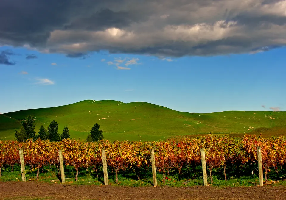
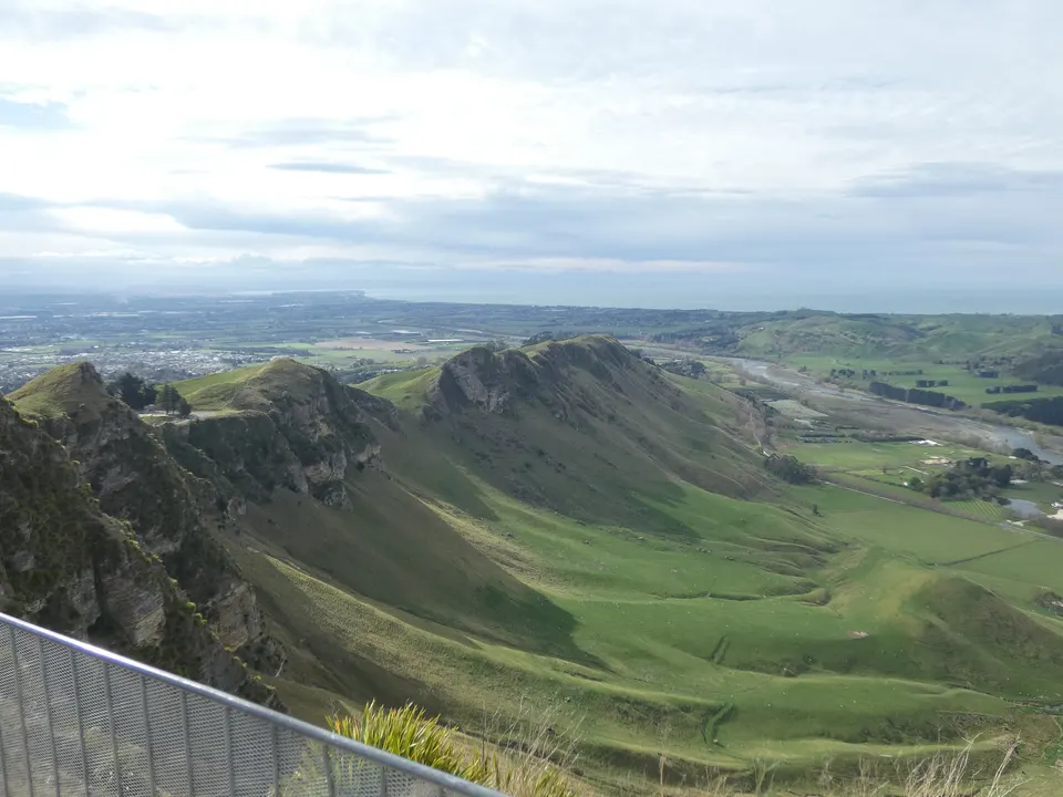
Hastings is the city on the Heretaunga Plains, about 20 minutes’ drive from Napier, and Havelock North is the village at the foot of the 399 m Te Mata Peak. Around them are orchards, the Gimblett Gravels and Bridge Pā wine districts and flat cycle trails. goBay buses link Napier, Hastings and Havelock North.
What is there to do in Hastings and Havelock North?
Hastings is a grid-plan city on the Heretaunga Plains, and Te Ara says orchards, market gardens and vineyards are still central to its economy. Much of the city centre was rebuilt after the 1931 earthquake, and Heritage New Zealand lists a stretch of Russell Street for its Spanish Mission and Art Deco shops. On Sunday mornings the Hawke’s Bay Farmers’ Market sets up in Waikoko Gardens at the Tōmoana Showgrounds.
Havelock North sits below Te Mata Peak, which has a road to the top and walking trails through Te Mata Park. In summer the council-run Splash Planet water park on Grove Road in Hastings is open; its long-term future is being reviewed in the council’s Long Term Plan.
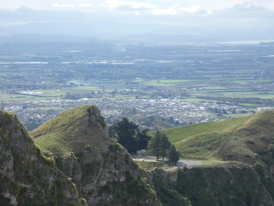
Te Mata Peak
The 399 m peak above Havelock North, with a summit road and seven marked trails in Te Mata Park.
Good to know & how to get there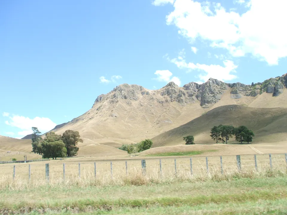
Hawke’s Bay Farmers’ Market
Growers’ market every Sunday, 8.30 am to 12.30 pm, at the Tōmoana Showgrounds in Hastings.
Good to know & how to get there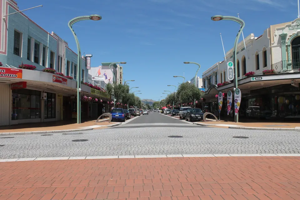
Hastings heritage walk
Free self-guided stroll past the Spanish Mission and Art Deco shops rebuilt after the 1931 earthquake.
Good to know & how to get there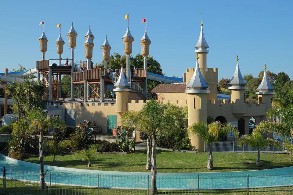
Splash Planet
Council-run water park in Hastings, open each summer from mid-November; a dry Play Park at weekends.
Good to know & how to get thereHow do you get to Hastings and Havelock North?
By car, Hastings is about 20 minutes from Napier, Tourism New Zealand says. Hawke’s Bay Airport, on the northern edge of Napier, is about 25 minutes’ drive from Hastings (Hawke’s Bay Tourism).
The regional goBay buses run for Hawke’s Bay Regional Council. On the network that started in January 2026, Route 1 links Napier, Hastings and Havelock North, Route 11 runs from Napier to Hastings via Clive, and Route 4 runs from Napier via the airport to Bay View. Timetables and fares are on the goBay website.
| Visitor centre | Where | Opening hours |
|---|---|---|
| Hastings i‑SITE | Ground floor, Municipal Building, Heretaunga Street East | Monday to Friday 9.30 am to 4.30 pm, Saturday 10 am to 2 pm |
| Havelock North i‑SITE | Corner of Middle and Te Aute Roads | Monday to Saturday 10 am to 2 pm |
Both i‑SITEs are closed on Sundays, Christmas Day, Good Friday and Anzac Day. Hours can change, so check the council’s i‑SITE page before you go.
How high is Te Mata Peak, and can you drive to the top?
Te Mata Peak is 399 m high, according to Te Ara and Hawke’s Bay Tourism. It stands in Te Mata Park, which John Chambers’ sons gave to the people of Hawke’s Bay in 1927 and which volunteer trustees of the Te Mata Park Trust still run. Te Mata Peak Road climbs from Simla Avenue to the summit; its upper section is closed to vehicles from 10 pm to 5.30 am every day.
Seven marked walking trails run from 0.5 km to 5.5 km. In extreme fire conditions the trust can close the whole park, and the road can be closed too, so check the park’s website first on hot, dry, windy days. Trails, the summit road and the Rongokako story are on our Te Mata Peak page.
What is Havelock North village like?
Locals call Havelock North “the village”. Te Ara describes it as the urban centre of Hawke’s Bay’s wine country, known today for boutique vineyards and restaurants. The government founded the town in the late 1860s and named it after the British general Sir Henry Havelock. Orchards appeared from the 1870s, and Bernard Chambers planted the first vineyard here in 1892.
Te Mata Road leads from the village centre towards the peak, and Hawke’s Bay Tourism lists several cellar doors along it. The Hawke’s Bay Trails ride to Clive starts in the village.
Where can you buy fruit on the Heretaunga Plains?
Orchards and market gardens surround Hastings. Te Ara notes that the first freezing works opened at Tōmoana in 1884 and that the food company Wattie’s, founded in 1934, is the best-known local business. Tourism New Zealand says roadside stalls sell pipfruit and fresh produce in summer.
All year, the Hawke’s Bay Farmers’ Market sells produce from the region’s growers every Sunday morning.
Where are the Gimblett Gravels and Bridge Pā wine districts?
Both are west of Hastings. The Gimblett Gravels is a winegrowing district of about 800 ha of stony ground, laid down by the old Ngaruroro River and exposed after floods in the 1860s (Hawke’s Bay Tourism). Te Ara says it lies next to Flaxmere, that a winegrowers’ association registered the name in 2001, and that wineries must meet strict standards to use it.
The Bridge Pā Triangle is the area between Ngatarawa Road, State Highway 50 and Maraekakaho Road, with a cluster of cellar doors. Hawke’s Bay Wine says the region grows about 90% of New Zealand’s Syrah, Cabernets and Merlot.
Cellar doors open, close and change hands, so use Hawke’s Bay Tourism’s cellar-door guide and check each winery’s own website for hours before you go. Nobody pays to be on this site, so we do not rank them.
Can you cycle from Hastings to Clive and the wineries?
Yes. The Hawke’s Bay Trails have more than 178 km of cycle trail, and several rides start in this area:
Clive is a small town between Napier and Hastings. It began as a trading post in 1850, when it was known by its Māori name, Waipūreku (Te Ara). The river beside it is Te Awa o Mokotūāraro (formerly Clive River); LINZ says the name became official when it was published in the New Zealand Gazette on 7 June 2023. The river runs from the Pakowhai Road bridge, north-east of Hastings, to the mouth of the Ngaruroro River.
Trail closures and detours are posted on the Hawke’s Bay Trails news and alerts page.
- Havelock North to Clive: 18.5 km one way, grade 1, from the village to the coast at Clive.
- Wineries Ride: 30 km from Roy’s Hill Reserve or 60 km from Clive, grade 1, through Bridge Pā village and past several wineries.
- Tukituki River Ride: about 58 km return from Havelock North, grade 3, with hills.
- Cape Coast: Clive to Clifton, 15 km, grade 1 to 2.
Questions about Hastings & Havelock North
How far is Hastings from Napier?
About 20 minutes by car, Tourism New Zealand says. goBay Route 1 buses run between Napier, Hastings and Havelock North.
Is there an i‑SITE in Havelock North?
Yes, at the corner of Middle and Te Aute Roads, open Monday to Saturday from 10 am to 2 pm. The Hastings i‑SITE is in the Municipal Building on Heretaunga Street East.
How high is Te Mata Peak?
399 m. You can drive to the summit on Te Mata Peak Road or walk up on the Te Mata Park trails.
When is the Hastings farmers’ market?
Every Sunday from 8.30 am to 12.30 pm, at Waikoko Gardens, Tōmoana Showgrounds, Kenilworth Road.
Is Splash Planet open?
In summer. Hastings District Council says the water park opens each summer between mid-November and early February; the rest of the year a dry Play Park opens at weekends. Dates are on the Splash Planet hours page.
Sources
Checked 19 November 2026 against these sources. Rules, prices and times change, so check the official page before you go. How we check facts
- Tourism New Zealand: Hastings
- Hawke’s Bay Regional Council: New bus network (3 February 2026)
- goBay: timetables and routes
- Hastings District Council: i‑SITE visitor centres
- Hawke’s Bay Tourism: i‑SITE visitor centres
- Te Ara: Hawke’s Bay places – Hastings, Flaxmere, Gimblett Gravels
- Te Ara: Hawke’s Bay places – East of Hastings (Havelock North, Te Mata Peak, Clive)
- Hawke’s Bay Tourism: Te Mata Peak
- Te Mata Park Trust
- Te Mata Park: Directions and opening times
- Te Mata Park: Walking trails
- Te Mata Park: History
- Te Mata Park: Park to temporarily close due to extreme fire risk (9 January 2026)
- Heritage New Zealand: Russell Street Historic Area (List No. 7020)
- Hawke’s Bay Farmers’ Market: Visit us (Hastings)
- Hawke’s Bay Farmers’ Market: Our story
- Hastings District Council: Splash Planet
- 1News: Hastings theme park Splash Planet needs a $34.7m fix over 15 years (10 November 2026)
- Hawke’s Bay Tourism: The complete guide to winery cellar doors
- Hawke’s Bay Wine
- Hawke’s Bay Trails: Ride our trails
- Hawke’s Bay Trails: Trail news and alerts
- LINZ: Te Awa o Mokotūāraro (name change from Clive River)
- Wikipedia: Hastings, New Zealand (coordinates)
- Wikipedia: Havelock North (coordinates)