

Tūtira & the north coast
Bay View · Whirinaki · Tangoio · Waipātiki Beach · Lake Tūtira · Maungaharuru Range
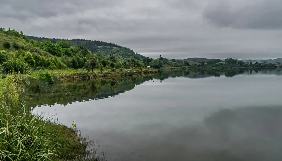
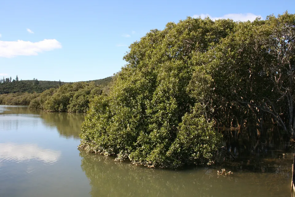
The coast and hills north of Napier along State Highway 2: Bay View and Whirinaki on the shore, Waipātiki Beach down a side road, and Lake Tūtira, 41 km north of Napier. Inland, DOC’s Boundary Stream Mainland Island on the Maungaharuru Range has Shine Falls and Lake Opouahi, about an hour’s drive from Napier.
What is there to do north of Napier?
State Highway 2 leaves Napier past Bay View and Whirinaki, follows the coast to Tangoio and then climbs inland to Lake Tūtira. Hawke’s Bay Regional Council runs Tūtira Regional Park around Lake Tūtira and the smaller Lake Waikōpiro, with two campsites and walking tracks. Just north of the lake, Matahorua Road leads up into the Maungaharuru Range, where DOC’s Boundary Stream Mainland Island has Shine Falls and the Bell Rock lookout, and Lake Opouahi has a kiwi crèche.
On the coast, Waipātiki Beach is 11 km off State Highway 2, down a steep, long road into a bush valley, with a camping ground, toilets and a lifeguard patrol in early summer. At Tangoio, DOC reopened White Pine Bush Scenic Reserve beside the highway in July 2024, after repairing bridges and tracks damaged by Cyclone Gabrielle.
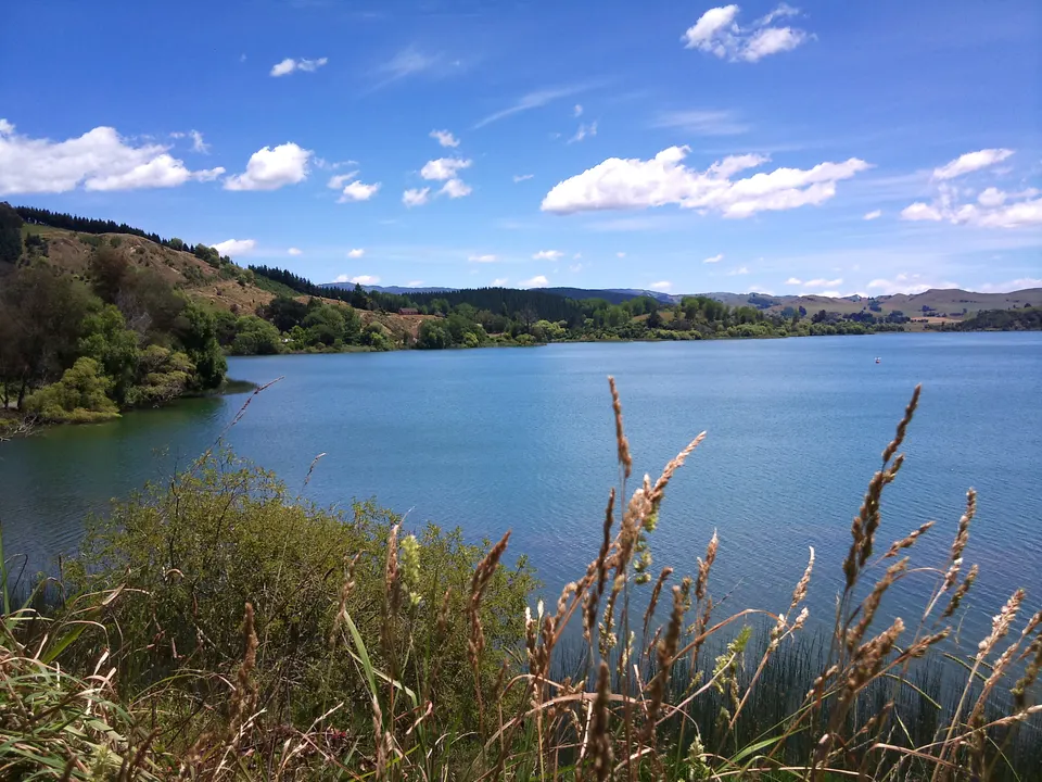
Lake Tūtira
Lake 41 km north of Napier with free DOC and paid council camping and the walk to Table Mountain Trig.
Good to know & how to get there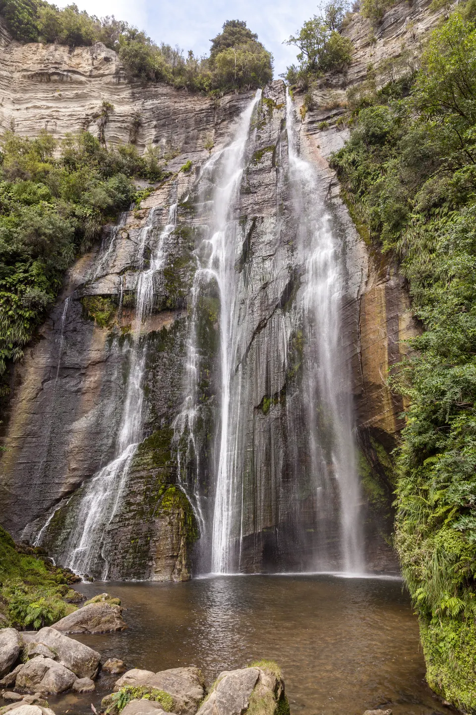
Shine Falls & Boundary Stream
58 m waterfall, the highest in Hawke’s Bay: 1 h 30 min return in DOC’s Boundary Stream. Check DOC first.
Good to know & how to get there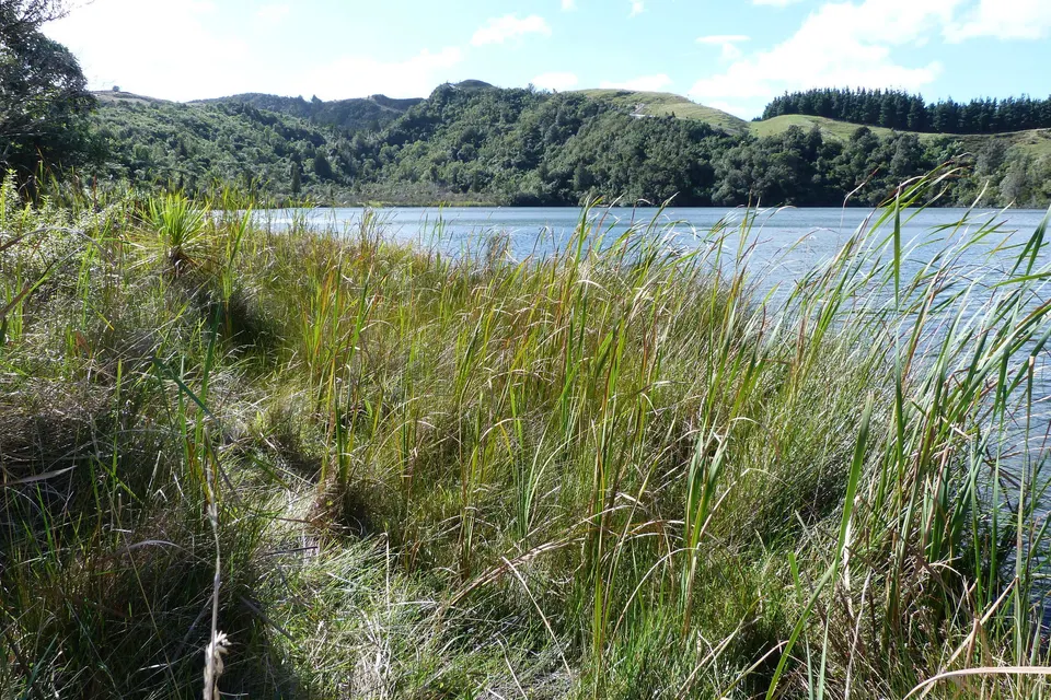
Lake Opouahi
Small bush lake with a 40-minute walk inside the predator-proof fence of the Opouahi Kiwi Crèche.
Good to know & how to get there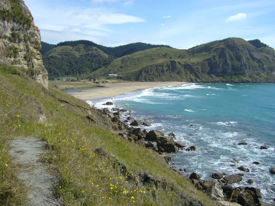
Waipātiki Beach
Sandy beach in a bush valley 11 km off SH2, with a camping ground and lifeguards from mid-December.
Good to know & how to get thereCan you camp at Lake Tūtira?
Yes, in two places. DOC’s free Lake Tūtira Campsite is at the park gateway as you turn in from State Highway 2, and it is open all year. About 950 m further in, the council campground is a flat, fenced paddock for tents, campervans and caravans. It costs NZ$15 per vehicle per night. Pay online before you arrive, because mobile reception is limited, and keep proof of payment.
The council campground has compost toilets and cold taps, but the water is for handwashing only, so bring water for drinking and cooking. There are no kitchens or showers. Fires are not allowed at any time, and dogs, cats and other pets are banned because the park is a wildlife reserve. DOC’s campsite page says the council campground closes from 1 July to 30 September for lambing; the council’s own page does not say so, so check before a winter trip.
What walks are there at Lake Tūtira, and can you swim?
DOC’s Tūtira Walkway climbs to Table Mountain Trig, with views to the Kaweka and Maungaharuru ranges and along the coast from Māhia to Cape Kidnappers. DOC’s track page gives 2 hours, or 4.5 hours via Kahikanui Track and 5 hours via Galbraith’s Track. The council lists Table Mountain Track, Pera’s Track, Kaitaratahi Track and the Valley Walk as open. The forestry and paddock area north of the campground, including Galbraith’s Track, is closed for an extended period, so DOC’s 5-hour long loop is not available. Tracks get boggy and slippery in wet months.
Hawke’s Bay Regional Council says the lakes are unsuitable for swimming because of periodic algal blooms and duck itch. Only boats without motors are allowed. Wash kayaks and boats before they go in the water, to stop the spread of aquatic weeds.
How long is the walk to Shine Falls?
Shine Falls drops 58 m and is the highest waterfall in Hawke’s Bay. DOC allows 1 hour 30 minutes return from the car park on Heays Access Road; its 2019 brochure gives 4.4 km return. The track crosses farmland, then follows streams through kānuka and kawakawa forest under limestone bluffs to a small viewing area near the base of the falls. From State Highway 2, turn onto Matahorua Road at Tūtira, drive about 11 km and turn left onto Heays Access Road. Hawke’s Bay Tourism says the last 12 km are gravel.
The track was closed for a long time after Cyclone Gabrielle in February 2023. DOC’s current Shine Falls Track page says visitors can experience the falls again after restoration work, but the section from the falls to Kamahi Loop stays closed. Some other pages still describe the falls as closed, so check DOC’s Shine Falls Track page before you go.
What is Boundary Stream Mainland Island?
Boundary Stream is one of DOC’s mainland islands, where intensive pest control protects native forest and birds; the restoration project began in 1996. DOC’s brochure puts it at about 800 ha, from about 300 m to 950 m above sea level. Kiwi and North Island robins have been brought back since 1998, and kōkako since 2001, when 10 birds came from Te Urewera. DOC links the name Maungaharuru to the sound of the birdlife rising from the forest. Dogs are not allowed.
The Bell Rock Loop Track starts from the Pohokura Road entrance. DOC allows 3 hours and calls it easy, but steep and strenuous in places; Bell Rock is a lookout about 40 minutes along the left-hand track, and the return track looks over the Mōhaka valley. Lake Opouahi, also on Pohokura Road, has a 40-minute walk around the lake. The last part of the drive to both is on narrow gravel road.
What is at Bay View, Whirinaki and the Esk Valley?
Bay View is the northern edge of Napier, on State Highway 2 just north of Westshore and Hawke’s Bay Airport. The Water Ride of the Hawke’s Bay Trails, a 35 km Grade 1 loop from Ahuriri that takes 2 to 3 hours, follows the coast on a concrete path towards Bay View before turning inland through the wetlands.
Just north of Bay View, the Esk River reaches Hawke Bay, and Whirinaki is a small coastal settlement nearby. State Highway 5 to Taupō turns inland here.
What should you know about tsunami and roads on this coast?
The tsunami evacuation zone for the coast from Tangoio to Clifton was redrawn on 19 August 2026; the current map is on the Hawke’s Bay Emergency Management tsunami page. A tsunami from a nearby earthquake could arrive within 15 minutes. If an earthquake is long (more than a minute) or strong (hard to stand up), go straight to high ground or as far inland as you can, on foot or by bike.
Te Ara notes that the land between Lake Tūtira and Wairoa is particularly prone to slips, and the causeway into Tūtira Regional Park can go under water in heavy rain. Roads can close after storms: check NZTA’s Journey Planner for State Highways 2 and 5, and DOC’s Hawke’s Bay alerts for tracks, before you go.
Questions about Tūtira & the north coast
How far is Lake Tūtira from Napier?
Hawke’s Bay Regional Council puts Tūtira Regional Park 41 km north of Napier on State Highway 2, and 77 km south of Wairoa. Hawke’s Bay Today describes it as just under an hour’s drive from Napier.
Is Shine Falls open?
DOC’s Shine Falls Track page says visitors can return to the falls after restoration work, with the section to Kamahi Loop still closed. Some older pages still say the falls are closed, so check DOC before you go.
Can you swim in Lake Tūtira?
Hawke’s Bay Regional Council says the lakes are unsuitable for swimming because of periodic algal blooms and duck itch.
Can you take a dog to Lake Tūtira or Boundary Stream?
No. Dogs and other pets are banned in Tūtira Regional Park, DOC’s Boundary Stream brochure says no dogs, and Hawke’s Bay Tourism says dogs are not permitted at Opouahi.
Is Waipātiki Beach patrolled?
Yes, for part of the summer. Hastings District Council says surf lifesavers patrol for about six weeks, from mid-December to near the end of January, 11 am to 6 pm.
Sources
Checked 19 November 2026 against these sources. Rules, prices and times change, so check the official page before you go. How we check facts
- Hawke’s Bay Regional Council: Tūtira Regional Park
- Hawke’s Bay Regional Council: Te Waiū o Tūtira
- Hawke’s Bay Today: Can I go to Tūtira Regional Park? (20 December 2023)
- DOC: Tūtira area
- DOC: Tūtira Walkway
- DOC: Lake Tūtira Campsite
- DOC: Boundary Stream area
- DOC: Boundary Stream Mainland Island brochure (July 2019, PDF)
- DOC: Shine Falls Track
- DOC: Bell Rock Loop Track
- DOC: Opouahi Walkway
- DOC: Two Hawke’s Bay sites re-open to public (1 August 2024)
- Hawke’s Bay Today: What tracks and sites remain closed almost three years on (22 December 2025)
- Hawke’s Bay Tourism: Shine Falls
- Hawke’s Bay Tourism: Opouahi Scenic Reserve
- Hastings District Council: Waipātiki Beach
- Ngā Haerenga New Zealand Cycle Trails: Hawke’s Bay Trails
- Hawke’s Bay Emergency Management: Tsunami
- Hawke’s Bay Emergency Management: Tsunami evacuation zone updated (19 August 2026)
- Te Ara: Hawke’s Bay region – landscape
- NZTA Journey Planner
- DOC: Hawke’s Bay alerts
- New Zealand Gazette: New and altered geographic names, Maungaharuru-Tangitū Hapū Claims Settlement Act 2014 (2015-ln1104)
- Wikipedia: Bay View (location)
- Wikipedia: Esk River (Hawke’s Bay) (geography)
- Wikipedia: Whirinaki, Hawke’s Bay (location)
- Wikipedia: Te Pōhue (location)
- Wikipedia: Lake Tūtira (background)