

Hawke’s Bay Trails: rides, maps and bike hire
Stay Hawke’s Bay travel guide · checked 19 November 2026
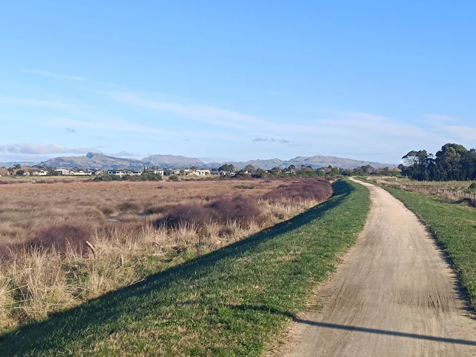
The Hawke’s Bay Trails are a network of mostly flat, off-road cycle and walking paths around Napier, Hastings and the coast, and one of the Great Rides of Ngā Haerenga, the New Zealand Cycle Trail. The three main rides, Water, Landscapes and Wineries, add up to 178 km on the current map. Ngā Haerenga allows 1 to 4 days for the whole network.
Key facts
| Status | One of the Great Rides of Ngā Haerenga, the New Zealand Cycle Trail |
|---|---|
| Length | 178 km on the official map (Water 79 km, Landscapes 53 km, Wineries 46 km); often given as about 200 km |
| Grade | Grade 1 to 3, easiest to intermediate |
| Surface | Mostly lime sand; also gravel, concrete, asphalt and some road sections |
| Time | 1 to 4 days for the whole network |
| Managed by | Hawke’s Bay Regional Council (trail information 0800 108 838) |
| Bike hire | Several operators; see the list on the official trails website |
What are the Hawke’s Bay Trails?
The Hawke’s Bay Trails are cycling and walking paths that link Napier, Hastings, Havelock North and the coastal villages. Most of them run along stopbanks, rivers, the estuary and the sea, so they are mostly flat. The network is one of the Great Rides of Ngā Haerenga, the New Zealand Cycle Trail. The official trails website says there are 23 Great Rides.
Hawke’s Bay Regional Council looks after the trails and runs the official website, hbtrails.nz. The trails are open all year. Ngā Haerenga suggests spring for the blossom, autumn for the colours, and summer for events such as the Art Deco Festival.
Ngā Haerenga gives 1 to 4 days for the network and recommends a cruiser, a path bike or an entry-level mountain bike rather than a road bike.
How long are the Hawke’s Bay Trails?
It depends on what is counted. The official trail map lists three rides that add up to 178 km of easy trails: the Water Ride (79 km), the Landscapes Ride (53 km) and the Wineries Ride (46 km). The same map shows a further 135 km of iWay city cycle routes in Napier and Hastings, which link to the trails, often on roads and cycle lanes.
Other official pages round the figure. The council’s trails page and the trails website say nearly 200 km, the trails website’s own page summary says over 200 km, and Ngā Haerenga says about 200 km. The council’s note on cyclone repairs refers to a 200 km network. You may also see larger numbers in older material. We use the map’s 178 km for the three rides, because it is the only figure broken down by ride.
Which rides can you do?
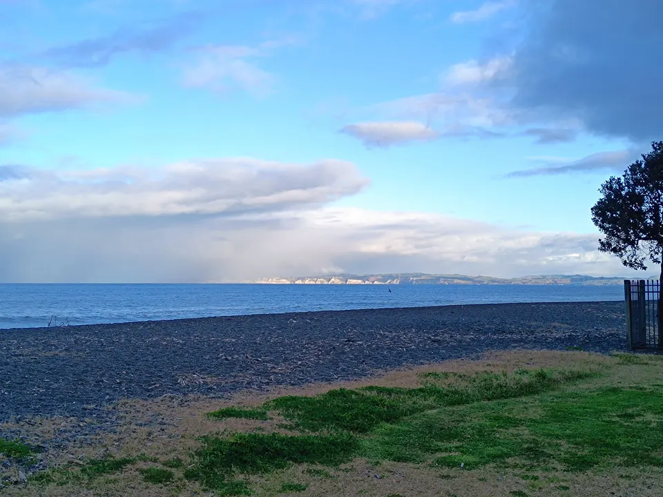
The trails are grouped into three named rides, plus loops that join them:
| Ride | Length (map) | What you see |
|---|---|---|
| Water Ride | 79 km | The sea, the Ahuriri Estuary and the rivers around Napier, including Marine Parade. Flat and family-friendly. |
| Landscapes Ride | 53 km | The coastal villages of Haumoana, Te Awanga and Clifton, with views of Cape Kidnappers / Te Kauwae-a-Māui and Te Mata Peak. Some road sections, such as on Tukituki Road and Waimārama Road, are for riders used to traffic. |
| Wineries Ride | 46 km | Vineyards and cellar doors in the Bridge Pā Triangle, the Gimblett Gravels and the Ngatarawa area, west of Hastings. |
Two loops have their own names. The Puketapu Loop, inland from Napier, was one of the last sections repaired after Cyclone Gabrielle. The Tukituki Loop is the only section with notable hills, according to the council.
The Tukituki Trail between Waipukurau and Waipawa in Central Hawke’s Bay is a separate council trail and not part of the Great Ride.
What are the trail surfaces and grades?
Most of the network is firm lime sand, with some gravel, concrete and asphalt. Watch for loose stones, holes and ruts. The trails website recommends a bike with gears and medium to wide tyres. It uses three grades:
Some low areas and bridges, for example around the Ahuriri Lagoon and Awatoto, can flood at high tide. The trails website says to avoid these sections when the tide is over 1.7 m. Bring water and snacks on longer rides.
Keep left, slow down near walkers and ring a bell before passing. Dogs must be on a lead where they are allowed, and they are not allowed on some sections, such as the Water Ride past the airport between Bay View and Prebensen Drive. Horses are only allowed where horse trails cross, and motorbikes and other motor vehicles are banned.
- Grade 1: flat, off-road trails with gentle climbs. Walk any steep or loose bits if you are unsure.
- Grade 2: some short sections on quiet roads. For riders aged 12 and over with some experience; children need an adult.
- Grade 3: road sections with crossings and traffic at 80 to 100 km/h, or hill climbs. Same rider advice as Grade 2. Use the underpasses where there are any.
Are the Hawke’s Bay Trails open after Cyclone Gabrielle?
Cyclone Gabrielle damaged parts of the network in February 2023, and the council has repaired and reopened it section by section.
The full Puketapu Loop reopened on Saturday 4 July 2026, about three and a half years after the cyclone, once the new Waiohiki stopbank was finished, and the Tūtaekurī River stopbank section of the Water Ride between Awatoto and Puketapu fully reopened on 31 July 2026.
Work on stopbanks, bridges and the Hawke’s Bay Expressway still affects some sections from time to time, with closures and signposted detours. Before you ride, check the trail news and alerts page on the official trails website. The trail map is marked as indicative and also shows current detours.
Which sections suit wheelchairs, trikes and buggies?
The trails website suggests five rides as the most accessible for people using wheelchairs, mobility devices, trikes, larger bikes or child trailers:
Some routes have box gates or squeeze barriers to keep motorbikes out. The council says some wheelchairs fit through the box gates and suggests testing your equipment first. The Ahuriri underpass has tight corners and can flood at high tide.
- Ahuriri to the Waitangi star compass and back, about 24 km
- Napier to Bay View and back via Westshore, about 23 km, with gates, a farm section, short steep climbs onto a stopbank and road crossings
- Clifton to Haumoana and back, 14.6 km
- Ahuriri via Taradale to two wineries and back, about 24 km
- The Puketapu return ride on the side of the loop without squeeze barriers
Where can you hire a bike?
Several companies hire bikes, and some run guided or self-guided tours; one also offers a shuttle around the trails and wineries. The official trails website keeps the current list; on 19 November 2026 it listed seven bike hire and tour operators. We do not recommend one over another.
If you bring your own bike, goBay buses carry two bikes on a front rack, free, for bikes under 25 kg. Hawke’s Bay Airport has a locked bike port with a maintenance station for putting bikes together after a flight.
Questions
How long are the Hawke’s Bay Trails?
The official map lists 178 km for the three rides: Water 79 km, Landscapes 53 km and Wineries 46 km. Other official pages round the network to about 200 km.
Are the Hawke’s Bay Trails flat?
Mostly. They are graded 1 to 3. The Tukituki Loop near Havelock North is the only part with real hills, and the Landscapes Ride has some road sections.
Are the Hawke’s Bay Trails open after the cyclone?
Yes. The full Puketapu Loop reopened on 4 July 2026 and the Tūtaekurī stopbank section of the Water Ride on 31 July 2026. Some sections still close at times for stopbank or road works, so check the trail alerts before you ride.
Can you take an e-bike on the Hawke’s Bay Trails?
Yes. E-bikes are allowed, but the trails website asks riders to slow down near other users. goBay bus racks only take bikes under 25 kg.
Where do you hire bikes for the Hawke’s Bay Trails?
Several companies hire bikes and run tours. The official trails website, hbtrails.nz, keeps the list.
Sources
Checked 19 November 2026 against these sources. Rules, prices and times change, so check the official page before you go. How we check facts
- Hawke’s Bay Trails (official website, Hawke’s Bay Regional Council)
- Hawke’s Bay Trails: trail map
- Hawke’s Bay Trails: trail map (PDF)
- Hawke’s Bay Trails: trail news and alerts
- Hawke’s Bay Trails: tips and safety
- Hawke’s Bay Trails: trail accessibility
- Hawke’s Bay Trails: bike hire and tours
- Hawke’s Bay Trails: about us
- Hawke’s Bay Regional Council: Hawke’s Bay Trails
- Hawke’s Bay Regional Council: Tukituki Trail
- Ngā Haerenga New Zealand Cycle Trail: Hawke’s Bay Trails
- goBay: bus information (bikes on buses)
- Hawke’s Bay Airport: bike port